MapFan API Usage Scenario Examples
The blog "MAP WORLD+" introduces digital maps and GeoTechnologies, Inc. map services,We've selected articles related to the 'MapFan API' from case studies of companies that have implemented and are utilizing MapFan 's various corporate services.
-
- What is the 'MapFan API'?
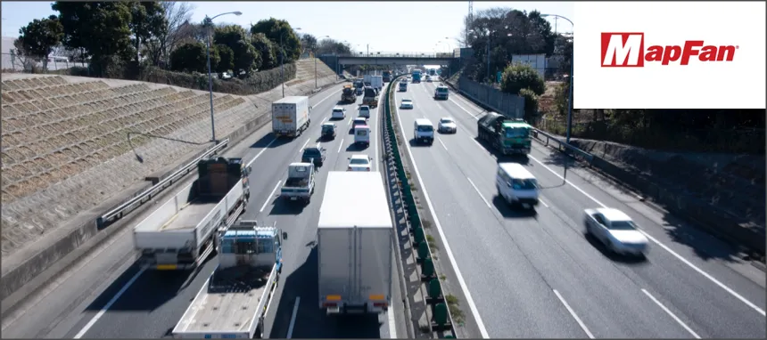
- For use in delivery planning and freight management in the transportation and logistics industry.
- Use for real estate business
- Use in multilingual support for inbound tourism, etc.
- Useful for calculating travel expenses when traveling by car on business trips or commuting by car.
- Realizing a wide range of solutions
- Reproduction and printing of maps
- Technical information for IT engineers
What is the 'MapFan API'?
This is a corporate development tool that enables the implementation of functions such as map display, route search, and address search using high-quality location data. By developing with the 'MapFan API', you can build web systems and web solutions that incorporate map functions and location information.
for example,
- Display a map on the website
- Draw shapes such as polygons on a map.
- Display place names and station names on the map in multiple languages.
- Show the address location on a map
- You can place pins on locations (stores, facilities, equipment, etc.) or moving objects* (cars, people, etc.), or display location information in speech bubbles.
- You can set the departure point, destination, and intermediate points to display the route and calculate the travel time, distance, and fare.
*The function to acquire the latitude and longitude of a moving object requires development by the customer.
These are some possibilities,
- Delivery planning and dynamic management in the transportation and logistics industry.
- Property management in the real estate industry
- Calculating travel expenses based on the distance traveled by car
- Tourist information for foreigners
It can be used in a variety of situations!
The articles below illustrate examples of what can be achieved using the MapFan API.
This page provides examples of how the MapFan API can be used in various scenarios, as well as implementation examples using the MapFan API. Please refer to them for your reference.
In addition, there are other usage scenarios, functions, and applications not mentioned here, so please feel free to contact us with any questions.
For use in delivery planning and freight management in the transportation and logistics industry.
In addition to standard route searches, we offer a variety of route search options to suit your needs, including circulating route searches that efficiently pass through multiple locations, route searches that take into account restrictions on large vehicles and toll roads.
-
MapFan API for the transportation industry
We introduce features that solve challenges and problems in transportation and logistics management, such as the automatic creation of efficient delivery routes that visit multiple locations while taking into account restrictions on large vehicles, and the ability to track the location and status of trucks during delivery.
-
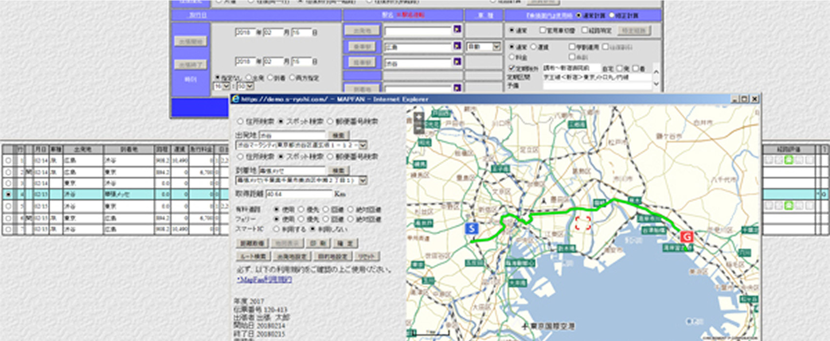
Truck route planning is now possible! MapFan 'Route Search'
The MapFan API allows you to specify various route search conditions, such as prioritizing distance, prioritizing road width, and specifying vehicle height, weight, and width.
-
Efficiently visit up to 30 locations! MapFan 's 'Map Tool' is convenient for deliveries and sales rounds.
The MapFan API allows you to obtain a route that includes up to 30 waypoints.
-
LOGICOMPASS The next-generation digital tachograph for transportation companies.
The system uses the 'MapFan API' to display real-time vehicle location information and construction/road closure/traffic congestion information for operational management.
-
DzLogger: A safe and secure vehicle operation management solution.
The function that displays the route and stops on a map utilizes the 'MapFan API'.
Use for real estate business
This system allows you to search for walking routes, which is essential for real estate work, and check the distance and time required. You can also use the optional "Future Information Surroundings Search" function, which provides information on changes to facilities up to three years in advance.

-
MapFan API for real estate property management
This section introduces features that solve challenges and problems in real estate property management, such as centralized property management on MapFan maps, printing maps needed for property viewings, and methods for creating hazard maps.
-
Streamline your real estate operations! MapFan: A convenient and feature-rich map website.
You can also use the print design and walking route search features introduced in this article via the 'MapFan API'.
-
DREAM STAGE-Fukuoka Rentals
This website, which primarily provides information on rental properties in Fukuoka City, uses the 'MapFan API' to display property maps and surrounding lifestyle information.
-
Real estate AI "Gate." enables one-click market analysis.
You are using the "Future Information Surroundings Search" option feature of the "MapFan API" within your real estate analysis business package.
-
"At Home Town Library" - a convenient resource for finding a place to live.
Our city information website features a "Future Information Nearby Search" function that allows users to view information about facilities planned to be built within the next three years.
Use in multilingual support for inbound tourism, etc.
We provide a map API that supports language display in 13 countries (14 languages).

-
Here are the top 5 problems foreign visitors face in Japan, and the number one result is quite surprising.
The challenges that inbound tourism can solve, as revealed by the Japan Tourism Agency's survey!We offer a multilingual map option through the MapFan API.
-
Real estate brokerage service website for foreigners
The multilingual map display function addresses the growing needs of Chinese investors.
Useful for calculating travel expenses when traveling by car on business trips or commuting by car.
MapFan API can streamline travel expense reimbursement processes.
-
A total travel expense management system! A "business trip expense system" for government agencies, universities, independent administrative agencies, local governments, and public institutions.
The 'MapFan API' is used in a system that provides comprehensive support for travel expense operations, from expense applications to automatic calculation of fares and daily allowances, and printing of orders and invoices.
-
"Moving Estimate Plus," an automated quotation service for moving companies.
Achieves accurate distance calculation using a full-fledged route search system, the same type used in car navigation systems.
Realizing a wide range of solutions
MapFan API enables the realization of a variety of solutions. The possibilities expand even further by combining MapFan API with various other data sources.

-
The importance of data utilization revealed by the COVID-19 pandemic.
What is "Civic Tech," the philosophy of the digital age?You can place and analyze various data on top of the base map and scrolling functionality of the 'MapFan API'.
-
Facility management is now possible with a pedestrian survey tool using MapFan API!
This is an example of integration into a smartphone app. It allows for plotting the current location and drawing shapes such as polygons.
Reproduction and printing of maps
We also offer flexible printing options. Please refer to the usage guidelines and various usage scenarios. We also introduce a map duplication service utilizing the 'MapFan API'.

-
Digital maps are also protected by copyright! You might be using them without permission without realizing it. Printing or reusing digital maps requires permission from the map-making company.
This document provides information about copyright related to digital maps.
-
Regarding map printing and usage: GeoTechnologies, Inc. offers a variety of professional map printing solutions!
We offer a wide range of map duplication and printing solutions to meet various needs.
-
"Freely edit and print!" Map service with usage license.
We use the 'MapFan API' for our web service that allows for secondary processing and various printing options for map images.
-
Smartphone app "Convenience store map printing"
You can easily create a map and print it using a multi-function copier at a convenience store chain.
Technical information for IT engineers
This page contains various helpful information about MapFan API for IT engineers.

-
Displaying MapFan API maps with Leaflet
This article shows you how to display a MapFan API map using the open-source JavaScript library, Leaflet.js.
-
Displaying MapFan API maps as layers in Leaflet
This section will introduce how to use Leaflet's layer function to switch between maps with different designs and how to display customer-owned data on the map.
-
Displaying MapFan API search results in Leaflet
This document introduces the functions of various search APIs and explains how to display their results in Leaflet.
Here are some examples and testimonials from companies that have implemented and are using MapFan 's various services for businesses.
Introducing a case study of implementing MapFan API