


We want to eliminate discrepancies in arrival times through more accurate dynamic management.
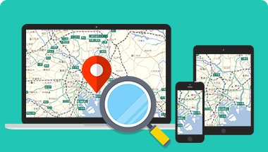
By linking with GPS information and displaying the vehicle's location on a map,
You can find out the exact location and estimated time of arrival.
To answer customer inquiries such as, "How much longer until we arrive?",
We need to check the driver's current location.
By linking with GPS information, the vehicle's location is displayed on a map.
Furthermore, by performing a route search from that location, it becomes possible to calculate the estimated time of arrival.
Additionally, optional features allow you to display real-time traffic information and show driving history data on a map, which can then be reflected in your daily report.
Recommended Services
What GeoTechnologies
can offer


By linking with GPS information, the vehicle's location can be displayed on a map, and by searching for a route from that location, it is also possible to calculate the estimated time of arrival. By managing the vehicle's movements on the map, you can accurately track its location and estimated time of arrival.

I want to display traffic congestion information on the map.

Using MapFan API or MapFan SDK (online access), you can display real-time traffic congestion information, traffic restriction information, and parking availability information provided by the Vehicle Information System Center (VICS) on a map, and perform route searches that take traffic congestion into account. GeoTechnologies, Inc. can also provide its own traffic congestion statistics data.

I want to record my travel route and create a daily report.

If you have log data of your driving history, you can display the day's travel route on a map. Furthermore, by obtaining address information from the latitude and longitude of the log data, you can create an address list of the driver's activity history and use it for reporting tasks such as creating daily reports.