GeoTechnologies’s map services can be used to accommodate a variety of customer needs. The possible applications for digital map are virtually limitless.
GeoTechnologies provides map solutions that can be used in a variety of scenarios where precise location information is needed. Examples includes offline environments, traffic control and sales supporting systems, just to name a few, all enabled by the technologies and experiences that brought dependable car navigation systems and MapFan data services to the market.
GeoTechnologies’s many services can be combined to accommodate your organization’s unique requirements.
Search by purposes & scenes
You can find a MapFan product by purposes/scenes
Delivery planning / Dispatch management

Manage the dispatch of trucks and taxis
Services for foreign tourists

Provide tourism information and other services to foreign tourists
Facility management
Check the status of facilities on a map
Printing/
Secondary use
Use maps in flyers, advertisements, and reports
Disaster prevention
Use maps for disaster prevention measures & countermeasures
Investigation/Analysis
Use map data in trade area analysis and Geographic Information Systems (GIS)
Store guide
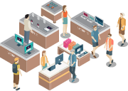
Use maps in real estate and store guides
Geocoding

Add latitude and longitude coordinates to address data
Expense settlement/Distance calculation
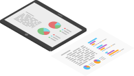
Settle travel expenses and distances
Entry simplification

Simplify entry fields of an inquiry form