

人流データを利用して、商圏分析や出店計画を行いたい。
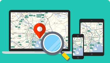
高精度な地図データを
幅広いGISソリューションにご利用いただけます。
カーナビやWebサービスで高い信頼と実績を持つデジタル地図を、GISソリューションに広くご利用いただけます。
1日に10億件以上の膨大な位置情報を取得している人流データ、開店・開業情報など3年先までの施設情報を独自収集した施設変化情報リスト、全国の道路リンク各地点の標高値を格納した道路標高などを利用することで、商圏分析、災害対策、行政支援、交通計画など、幅広いGIS分野でご活用いただけます。また、調査にご利用いただける、位置情報に基づいたリサーチサービスもございます。
おすすめのサービス
ジオテクノロジー
ズが提供できること


ジオテクノロジーズが保有する人流データを利用することで、 商圏分析や店舗計画などにご活用いただけます。MapFan APIの「道路通行量クラウド」、MapFan DBの「人流データ」としてご提供しております。

大型店舗の開店予定、道路開通予定情報などの未来の情報を利用したい。

開店・開業情報など施設の3年先までの変化情報を独自に収集しMapFan DBの”施設変化情報リスト”としてご提供しております。 エリアマーケティングや店舗計画の分野でご活用いただけます。

ゲリラ豪雨などで道路が冠水するところがあるか分析したい。

MapFan DBの道路標高データでは高速道路から国道、細街路まですべての道路を網羅しており、ゲリラ豪雨や洪水などの道路冠水分析にご活用いただけます。
導入事例
-


株式会社アスペリア 様
人流データ人流データによりイベントでの混雑状況の可視化ができるように!可視化情報から警備計画の見直しが可能となり、イベントでの事故防止とコスト最適化を同時に実現!
-


トヨタ自動車株式会社 様
Geo-Research【必要としている顧客はいるか?】新規事業の可能性を探る「顧客視点」での定量調査による仮説検証
-


株式会社いなげや 様
Geo-Research来店しない人からもアンケート取得可能!集計結果から、お客様のライフスタイルに合わせた販促施策を実施!
-


学校法人 愛知大学 様
人流データ「人流データ」の活用により、来場者の行動や人の動きの空間特性を客観的かつ効率的に把握することが可能に!
-


クロスロケーションズ株式会社 様
人流データエリアカバー率や解像度の高い人流データ採用で、より精度の高い人流分析が可能に!
-

株式会社NTTデータ 様
人流データ高解像度な人流データの活用で「道路通行量データ」の精度が格段に向上!