Digital maps for enterprises and other organizations that need unique location
and mapping services
The MapFan API is a map information distribution service that can be used for displaying maps and searching for routes and addresses on web systems and websites. This highly customizable API provides the same tried-and-true route search feature that’s relied upon every day in car navigation systems, as well as a rich variety of mapping options to meet the unique needs of any organization.
Our Japan map data services were among the first to support international map information to meet the needs of the growing number of foreign tourists in Japan, and can now display place and building/facility names in 14 languages. This powerful multilingual capability allows any organization to support applications for users from around the world.
Features
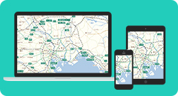
1 Various devices supported
Our map and location information can be used with a variety of devices, such as computers, smartphones, tablets, and digital signs.
2 An always up-to-date map
Our map is updated 12 times a year and reflects the opening of expressways and large facilities as soon as possible, thereby providing the latest map.
3 Maps support 14 languages for international users
MapFan API for Japan offers a map that supports 14 languages. For details, please contact us.

4 Full-fledged route search
MapFan API offers a full-fledged route search feature that is used in car navigation systems and the MapFan smartphone app and allows users to specify a variety of routing conditions.

5 OSS supported
Our map and location information can be used from various devices, such as PCs, smartphones, tablets, and digital signs.

6 VICS information supported
Traffic information can be displayed on a real-time basis in the MapFan API. Traffic data is sourced from the Vehicle Information and Communication System (VICS) Center.

7 Printing of the map and the use of cache
Our maps can be printed free of charge as long as they are used in-house. Map data cache can be used with an optional contract. For more information, please contact us.

Usage Scenarios
MapFan API can be used in a wide range of scenarios, including websites, in-house IT systems, and outdoor digital signs.
Major Features of MapFan API for Japan
Maps
Map display
Map tile images (in WMTS format) for JavaScript, usable in web browsers and static map images.
It is possible to acquire map tile images (WMTS format) for JavaScript operated on browsers and still map images allowing size specification.
Icon/Graphic display
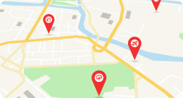
Any image and graphic can be rendered on the map.
Map style change
The default map style can be changed to any of a wide variety of standard map styles.
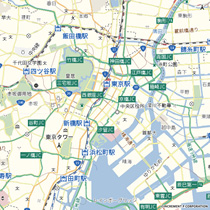 Standard
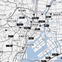 Grayscale
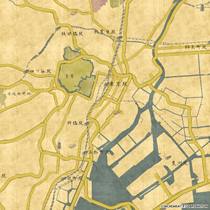 Antique map
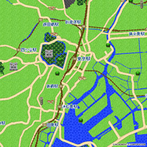 Retro game
For more information about other styles, please contact us.
CONTACTRoute Search
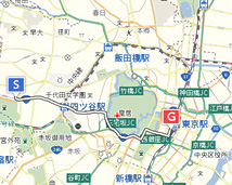
Route search
API users can search for driving routes.
Route search for Large vehicle restriction
API users can search for detours with large vehicle restrictions taken into consideration.
* Roads that can be avoided include: tunnels, roads beneath elevated roads, bridges, underpasses
* Supported areas: Tokyo; Osaka, Osaka; Nagoya, Aichi; and base roads (two lanes or more) across Japan, such as national and prefectural roads
Pedestrian route search
API users can search for pedestrian routes.
VICS traffic congestion considered route search (optional feature)
API users can search for faster routes to the destination with VICS traffic congestion information taken into consideration.
Multi-stop route search
API users can specify a start point, a destination, and multiple stop (via) points along the way and then search for efficient routes.
Up to 30 via points can be specified.
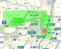
Specified area route search
API users can search for routes that are within a specified area, and avoid a specified area.
Various Searches
Address search
API users can obtain latitude and longitude information of corresponding to points from address strings.
Address hierarchy search
API users can search for address information that includes prefectures, municipalities and towns/blocks in a hierarchical manner.
Reverse address lookup search
API users can use latitude and longitude information to find address information.
Postal code search
API users can search for address information that matches a postal code.
Train station search
API users can search for information on a train station that matches a station name string.
Nearest train station search
API users can use latitude and longitude coordinates to find the nearest train stations.
Train station hierarchy search
API users can search for train station information, including railroad companies and line names, in a hierarchical manner.
Place search
API users can use a string to find place information (facility information). It is also possible to search Town Page Data for more detailed information.
* Town Page Data is optional, additional cost feature.
Neighboring place search
API users can use latitude and longitude coordinates to find neighboring place information (facility information).
It is also possible to search Town Page Data for more detailed information.
* Town Page Data is optional, additional cost feature.
