Digital Map Data Collection: The Work of Road Condition Surveyors


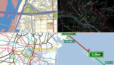
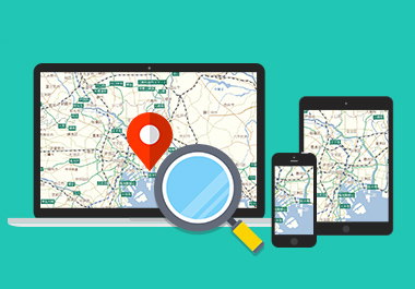
The value of a map lies in just how up-to-date it is. And because transportation infrastructure also changes as development progresses, maps are revised following each change. Such map data is delivered to users in various ways, including through map apps for smart device and GPS navigation.
Supporting the reliability of this kind of map data is Global Survey Corporation (GLC), which primarily conducts road traffic surveys. Ever since its founding in 2005, GLC has provided Increment P with road images and location information recorded by its road surveyors. This article introduces the work of the GLC road surveyors who steadfastly carry out these field surveys with driving and walking on roads, sidewalks, and so on.
Road surveyors and their travels around Japan
Is it easy for you to imagine what the field survey is actually like?
Here is an interview to Mr. Tanaka, who manages the road surveyors at GLC, about their surveys and surveyors.
Tanaka: ” GLC conducts road surveys by driving the roads throughout Japan. And in some cases we need to go to remote islands as long as we can reach them by ferries. Some of our surveyors have even gone to these kinds of islands in places as far away as Kagoshima. Remote islands are usually only serviced by ferries two or three times a day, and sometimes they are so distant that just getting to them uses up an entire day of the survey.”

Tanaka: “GLC road surveyors drive anywhere in Japan, even remote islands. Each road survey vehicle covers 50,000 km every year, and uses up a set of studded tires in a single season. Many of the road surveyors like traveling, so being able to “drive all over Japan” might just be one of the best part of being a surveyor.”
How do surveyors conduct these road surveys?
Tanaka: “We have divided Japan up into 10 square kilometer areas, which we assign to the responsible surveyor. The surveyors do their best to efficiently survey around their assigned areas.”
–This brings up a question for people like me who want to take it easy. So I might think during a survey, “hey, I don’t need to drive this road,” but is it possible to cut corners like this?
Tanaka: “There’s no way to cheat (laughs). First and foremost, none of our surveyors would do anything like that. And the camera inside each road survey vehicle takes photographs at a specific distance. These road images are then stored in a database. So, we can track everything, from where our surveyors are driving to when they are driving.”
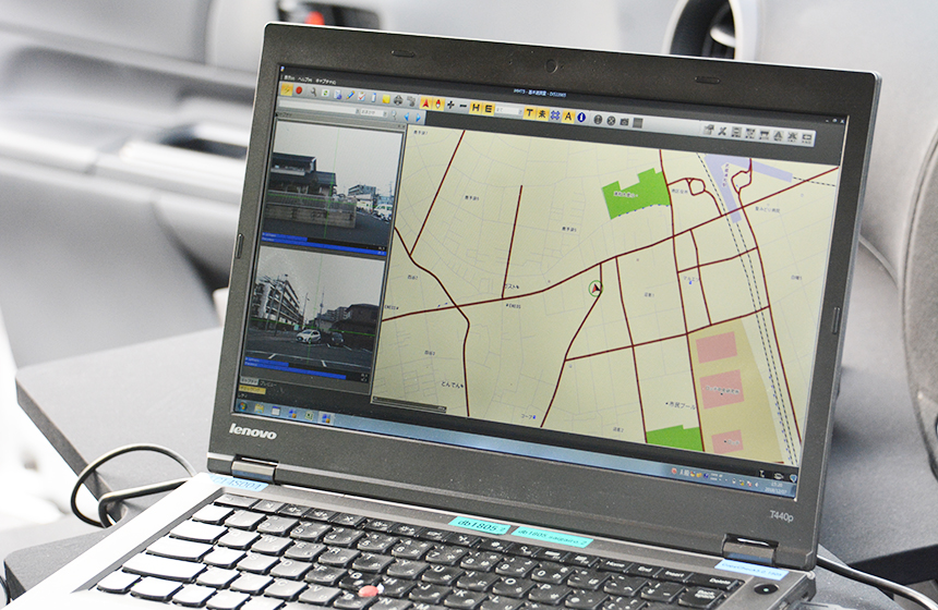
Apparently, this is something I don’t need to be concerned about. After all, with a computer recording everything, there really isn’t anyway to beat the system. And the map displayed on the specialized GPS navigation system indicates those roads that need to be driven in pink and those roads that have already been driven in grey. Each of these detailed management and efficiency systems supports the accuracy of maps, while still ensuring the surveys are conducted in a safe manner.
What about the period and time of days spent for the road survey
Tanaka: “The length of the surveys depends on the project, but for some of the longer surveys, surveyors can be out on the travel for surveying road for up to a month. And the vehicles used in road surveys only travel about the same speed as a regular car. The surveyors also only drive at a time of day that allows for photography, in other words, only from sunrise to sunset. In fact, many of surveyors start driving early in the morning because the surveys are easier to conduct at this time. In terms of weather, surveys can also be conducted as long as it is only raining lightly. The surveys are impossible to conduct during heavy rains, though, when water drops still appear in the images even with the windshield wipers turned on. Sometimes the surveyors get stuck in a hotel if this kind of bad weather continues and they cannot conduct their work for a few days in a row.”
–What other types of weather cause problems?
Tanaka: “When it snows we can’t survey the roads, because we can’t see the road markings under the snow. This is why we schedule our surveyors to survey around the more snowy areas like Hokkaido, Tohoku, and Hokuriku regions of Japan during the summer.”
Safety is a priority for road surveys!
Tanaka: “GLC purposefully does not set quotas for the distance our surveyors must drive. This is because we want to avoid forcing our surveyors to drive dangerously to meet such quotas. Even though we manage their work, in general we leave decisions on how far to drive up to the individual surveyor. Also, there are roads that do not appear so on the map, but are in fact found to be dangerous after arriving like when part of a road has collapsed. We also ask our surveyors to make their own decisions about turning back in these cases. It is extremely important to respect the opinions of those on the ground in order to ensure that our surveys are safe. We even had a surveyor who turned around because he encountered a bear (laughs).”
–I don’t doubt that I would turn back if I came across a bear (laughs).
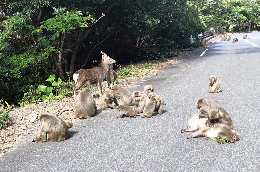
Surveyors also encounter monkeys and deer blocking the roads at times.
Tanaka: “We did ask the surveyor to reexamine the road where he encountered the bear, though (laughs). Dangerous roads are essentially valuable pieces of life-sized information that can only be discovered when our surveyors actually drive them.”
This just shows how the digital maps and map apps that we use are forever being improved by the road surveyors who update sensory information on dangerous roads and safe roads alike.
Road survey vehicle equipment
–What kind of vehicles do the surveyors drive?
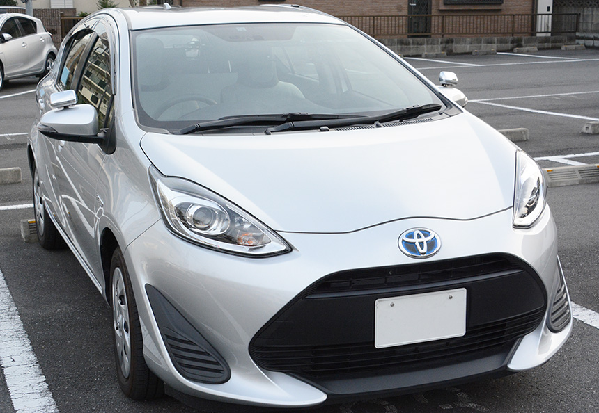
Tanaka: “We use Toyota’s Aqua for the road survey vehicles and Toyota’s Voxy for the verification vehicles. We use the same two models for all our vehicles so that they all handle the same. We also adopted the current vehicles given their overall balance, including their high durability. In winter we prioritize safety, for example by equipping all vehicles with studded tires regardless of the weather. “
・Standard survey vehicle
・Onboard camera and company specialized laptop
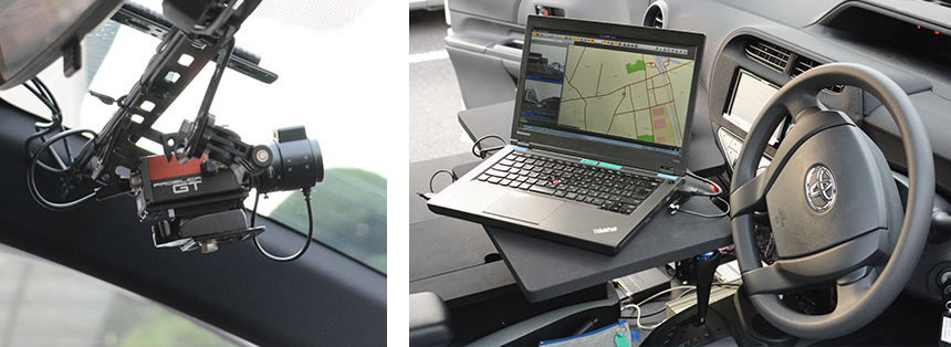
The images photographed every five meters by the onboard camera mounted on the front windshield are stored in a database in real time. The specialized laptop is equipped with a GPS navigation system so that surveyors can see at a glance where they are surveying and the areas that have already been surveyed. Other modifications have also been made to minimize the burden on the surveyors wherever possible, including installing a table in the vehicle so that they can use their laptop when the vehicle is stopped.
・Vehicles for verifying GPS navigation system
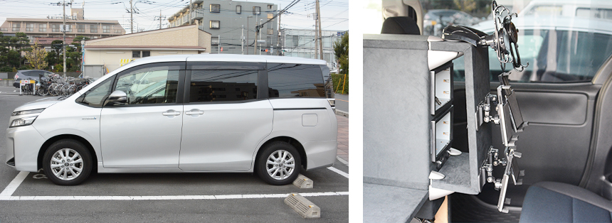
The verification vehicles are set to the Toyota Voxy. These vehicles are customized in various ways, including the installation of a verification unit mount to check GPS navigation systems and smartphone apps, and a photography arm. For example, this mount (on the right) can be loaded with multiple iPhones and other types of mobile devices.
Road surveys enable stress-free services
In addition to maintaining the quality of map information, GLC also surveys various targets in an effort to collect useful information for users. Since GLC conducts road surveys nationwide, they also undertake contracts for surveys to measure the strength of different radio frequencies. For example, by placing mobile phones inside each vehicle, GLC can measure electric field strength when driving and at each point of travel, and can also conduct a variety of radio frequency surveys, including those for FM radio frequencies and mobile devices.
GLC works to ensure its surveys are safe, thorough, and efficient. In fact, GLC’s road surveyors might be traveling around your town today, just so that you can use GPS navigation systems and map services without stress.
Click here to contact us for inquiry of map database and services.