What are “Road Driving Images?” — Increment P’s driving images where all roads in Japan are recorded


Do you know how the information of roads included in map applications you use every day have been surveyed? It is impossible to actually drive on all roads, isn’t it? Haven’t you had such a question in the past?
Increment P has surveyed all drivable roads in Japan by actually driving on the roads by car. When creating a map, we digitize a map database on the basis of a lot of data, including satellite photos, drawings, and data from governments and research institutions, and one of the pieces of data used is “road driving images.” While driving on a road in a car with mounted cameras, we take pictures of the road, and collect various information such as regulatory information, signboards on roads, regulation signs, and traffic lights, and reflect such information in the map.
At the Tohoku Development Center of Increment P in Morioka, they extract and maintain data from such road driving images. This time, we interviewed Mr. Maegawa and Mr. Kubo who were in charge of the maintenance of road information.
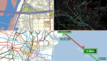
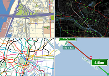
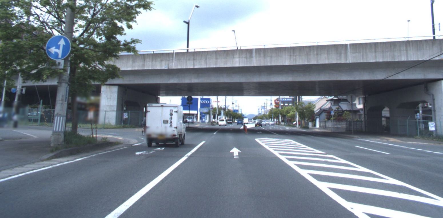
What are “Road Driving Images?"
— What is a “Road Driving Image?”
— It literally means an image that has been taken from a car while driving on a road.
At Increment P, a person drives on a road in a car with cameras mounted on the front and rear that capture images every five meters. It is easy to understand if you call up an image of something like Google Street View.

Front and rear cameras are mounted on a vehicle that takes road driving images.
Increment P’s maps are created on the basis of road driving images that have been taken all over the country.
— For road driving images, do you survey roads across the country, including narrow streets?
— Yes, we have driven on all roads in Japan at least once since the start of our survey in 2004. In recent years, we have been focusing on the survey of roads used in the route guidance of navigation systems.
The fact that we have surveyed roads throughout the country is a competitive advantage.
In addition, we need to focus on the survey of expressways and major roads after they open. We survey expressways every year, and for major roads after opening, we have conducted the road survey of such roads just after they open and also before they open. In addition, we have surveyed urban areas and the surrounding areas of prefectural capitals more frequently than the other regions.
The data of images that were taken and accumulated in such a way have been stored, including past data, so that all of such data can be utilized.
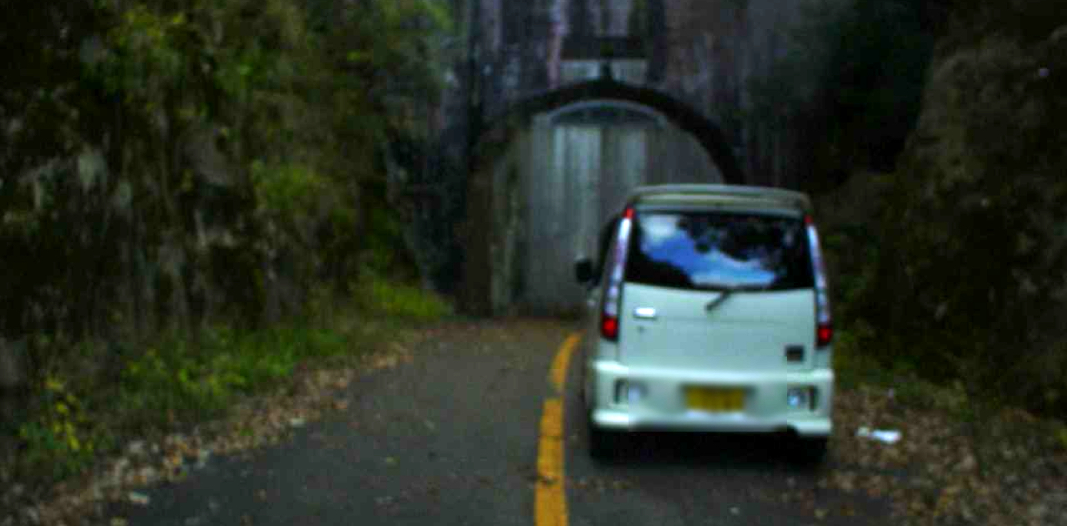
Closed tunnel. Rare landscapes like this are also taken because we drive on all roads across the country. * An image with the automatic privacy processing applied
— Has all past data also been stored?
— Yes, we have stored all data. Therefore, tremendous amount of data has been stored.
The number of images that have been taken so far is 2.6 billion or more, and the amount of data is well over 200 TB.
— That’s a huge amount of data! How and why did you start collecting such driving image data?
— Increment P started the road survey in November 2004. This was the first action as the road survey for creating Increment P’s maps.
The concept had been repeatedly tested from 2003, two years before, and the survey was started in November 2004. After that, we roughly finished the road survey all over the country in 2007.
As the result of the road survey covering the whole country, the total distance of the road network retained by Increment P has been increased by 28% from approximately 910,000 kilometers to approximately 1,210,000 kilometers, as compared to conventional maps. In addition to the distance, regulatory information and intersection names have also greatly increased.
“Number one road data inside Japan,” which was the original goal, has also been achieved. (*As of 2007)
Since then, Increment P has continuously conducted the road survey across the country on a regular basis.
— Are there many things that you cannot grasp unless you actually drive on roads?
— Yes. Information such as regulations cannot be acquired completely from drawings. Even if we maintain data on the basis of drawings, for example in expressways, actual zebra zones and bifurcation points may be different from the drawings.
Before conducting the road survey, we created our original maps according to data provided by autonomous communities and governments, and map data published by Japan Digital Road Map Association (DRM). However, the amount and accuracy of information have been improved dramatically by actually driving on roads because there was no detailed data at that time.
Analyzing a large amount of road driving images! AI-based data extraction work
— You said that you utilized road driving images for creating maps, but specifically, how do you actually use images?
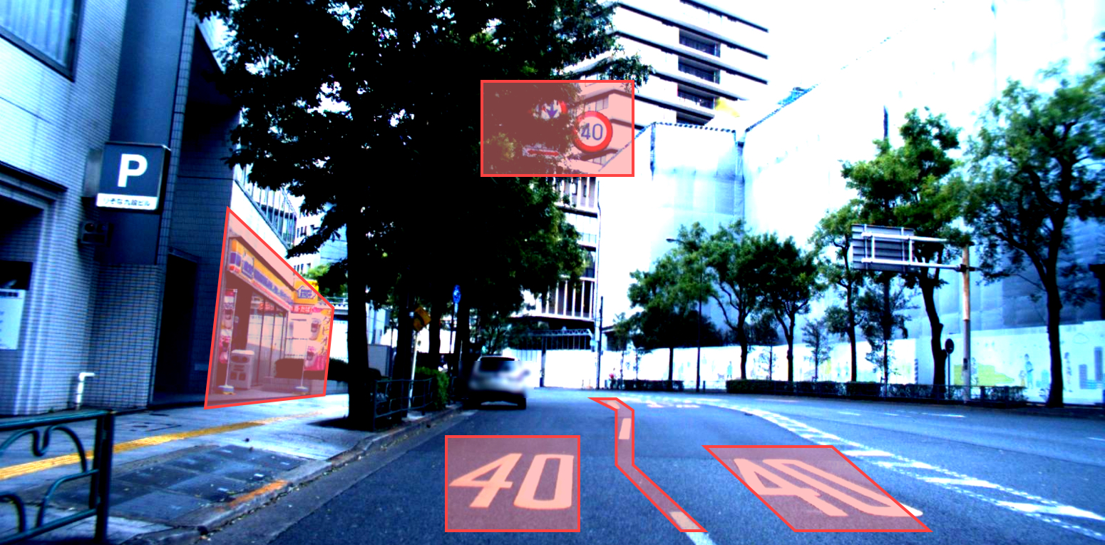
Road driving images are taken from a position near a driver’s viewpoint. Therefore, it is possible to efficiently collect information that drivers will see. By extracting such information, we have created road data that is the basis of map databases.
In addition to minimum information such as traffic lights and road regulation signs /displays, we also have extracted information such as roadside convenience stores from images. We capture images every five meters because it is the interval at which sign images can be taken clearly.
Information that has been extracted in such a way is represented on maps by assigning such information to roads.
— Do you extract individual data visually from road driving images?
— It is not realistic to handle a huge number of images visually. Therefore, in 2003, we started studying a mechanism of image recognition-based machine extraction in parallel to the preparation of the road survey, and we have prepared and introduced the mechanism. In recent years, AI technology has been introduced in this image recognition processing.
Information, such as regulation signs , has already been successfully extracted with considerable accuracy, and it is also possible to identify signs even when signs are partially hidden and not visible.
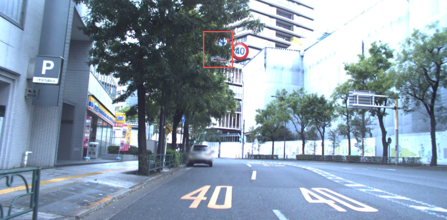
A sign that cannot be recognized by AI. IPC judge conditions by information such as past data, and conduct the survey again if needed. * An image with the automatic privacy processing applied
In addition, it is hard to check all images because we capture a huge number of images every year. Therefore, we have devised a method so that maps can be maintained efficiently by extracting change points.
A change point is a location where there is a change when comparing a map with an image. For example, if a traffic light exists in the image, but it does not exist in the map, then the light may have been newly installed. We maintain such a change as road data, and reflect such data in maps every month.
— In terms of AI-based information extraction, is it possible to recognize more targets automatically in the future by developing technologies?
— Yes, we think that more information may be acquired through the AI-based information extraction. However, we also have some issues to resolve before achieving the automatic information extraction.
For example, we have already worked on the character recognition of signboards. In this regard, the technology is in the research stage, and we have been developing it by trial and error.
Although it can be understood through the survey of roads across the country, the shape of a sign may slightly differ depending on municipality. For example, signboards for calling attention to animals on which various animals are printed. It is said that the standard designs of deer, monkey, raccoon dog, and rabbit are prepared by the Ministry of Land, Infrastructure, Transport and Tourism (MLIT).
Yet the designs differ depending on the region; for example, raccoon dogs face to the right in some regions and face to the left in the other regions. For other animals, original designs are used in each region. Therefore, there are different signs with various designs even for a sign with the same meaning.
Even for the signs and displays that have been standardized by the government, a minor change may be performed once every few months. Even for such a change, we must support it precisely.
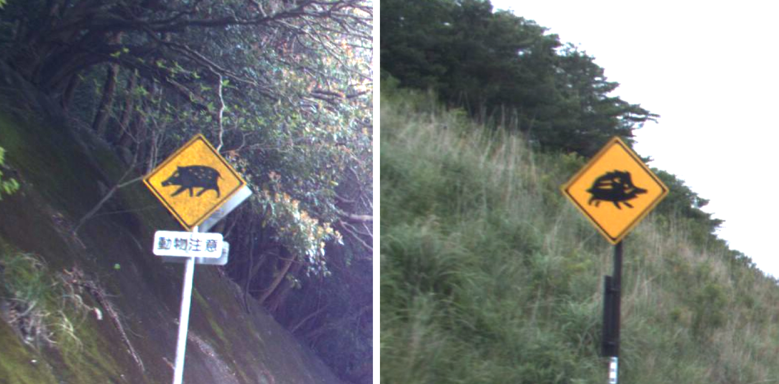
Signs for calling attention to animals, with different designs
We promote such technological development, which is because our goal is the future where changes are reflected in real time. At present, Increment P’s maps are updated monthly. However, we will need to update maps more frequently in the future. From monthly to weekly, and from weekly to daily. Reflect the changes of roads in maps more quickly. To do this, we need to automatize many operations that are now performed manually. Of course, even if all operations are successfully automatized, humans need to check data in the end to create a map.
— To create such a map, is the road survey still needed in the future?
— Yes, the road survey will be necessary.
Increment P’s driving images covering all roads across the country are of particular value. Recently, we can get road driving images themselves more easily than before because dashboard cameras are mounted in many cars and taxis. Yet it is not possible to cover all roads. Road driving images where the images of all roads have been taken according to the same criteria will also be necessary in the future.
In Increment P’s road survey, we clean the windshield hourly, and avoid adverse weather conditions when conducting the road survey. We drive on all roads across the country in such a way according to the plan. Maps of Increment P are supported by the road survey and road driving images with high quality.
Thank you for your time. So maps are created through actual road survey and the extraction work of road data.
Increment P’s driving images that can also be used in various services other than maps
As mentioned above, the road driving images across the country have been continuously taken for the maintenance of map databases since 2004, but new needs other than map information have also appeared. This is because valuable information other than information required for maintaining map databases is also contained in the images.
For example, the pavement conditions of roads. In the images that have been taken while driving on roads, not only signs and displays but also the roads themselves are of course included in the images. From the images, it is possible to detect where should be repaired by checking for a sign of the degradation of the asphalt.
Although the road maintenance is essential work for local governments that manage roads, it takes time and money if they conduct the survey by actually driving on all roads.
It is expected that the time and costs for maintenance can be greatly reduced by utilizing Increment P’s road driving images to check roads efficiently.
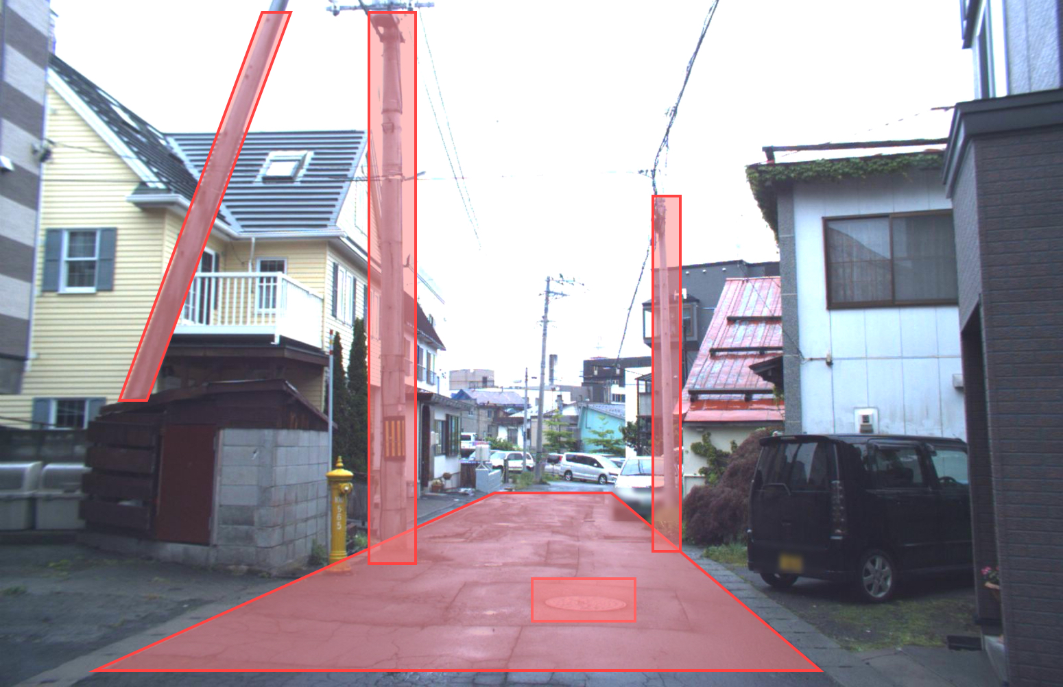
Degradation of asphalt and the inclination of a utility pole can be recognized. * Automatic privacy processing applied
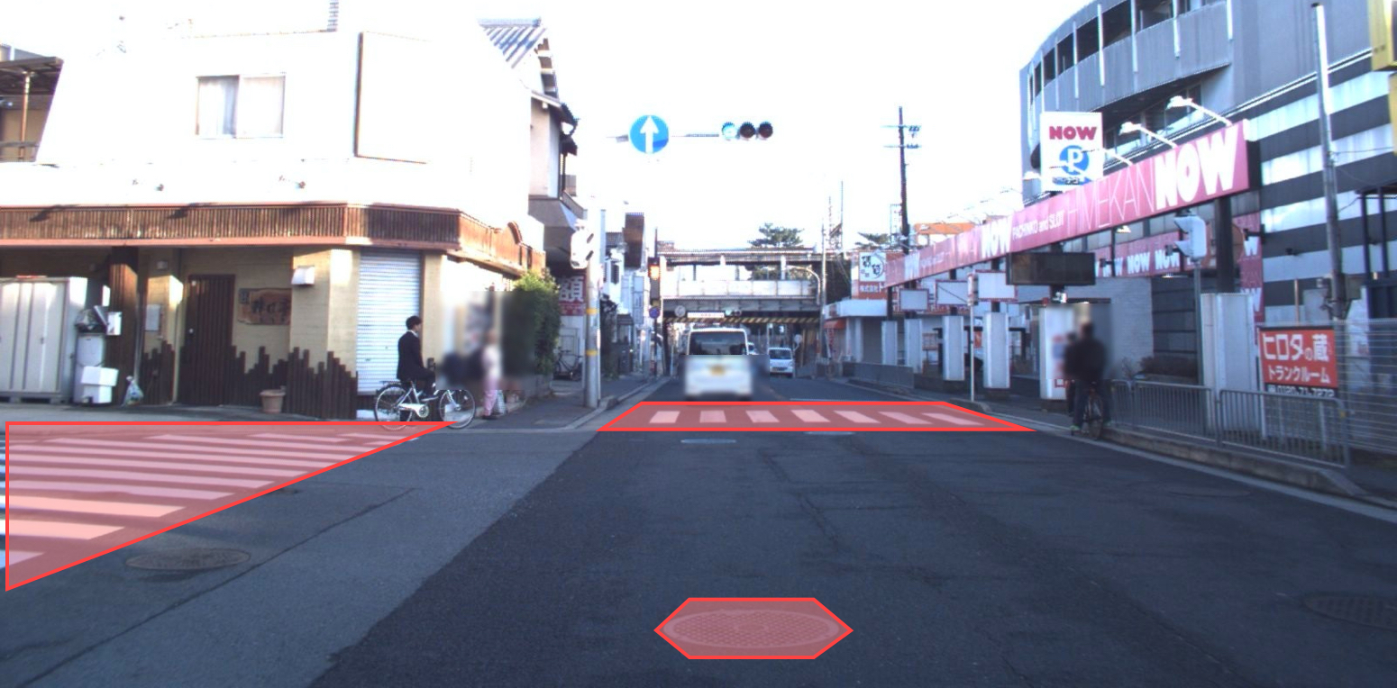
Condition of asphalt and manholes can be recognized. * Automatic privacy processing applied
Road driving images can also be utilized for maintenance management of road signs and markings. Whether a sign or marking does not exist in the location where it should exist can be checked, or whether it is not visible because it is hidden. Or, a sign or marking is hard to see because of degradation. For signs that must be repaired, it is possible to easily detect signs that may have to be repaired if Increment P’s driving images are used.
For road signs and markings, Increment P has been checking information every day for creating map databases, and for example, it is possible to share information on locations where signs are hard to see. (*Information at the time of the survey.)
Additionally, it is possible to check various things, such as the conditions of utility poles and bridge beams, positions of manholes, and guardrails for pedestrians, by using road driving images. There is a possibility that the efficiency can be improved in operations for checking various things on and alongside roads.
Furthermore, it is possible to compare current images with past images because all images have been stored since the start of the survey in 2004. Images could also be utilized in education and research institutions for regional research.
Bridge beam image 1 * Automatic privacy processing applied

Bridge beams and zebra zones are recognized. * Automatic privacy processing applied
This report features Increment P’s road driving images. The road driving images covering all roads across the country may be of help to your businesses. The scope of road driving images can be flexibly modified, for example, prefecture regions or municipality regions. Please contact us if you want to learn more about Increment P’s road driving images.
Click here if you have any inquiries about road driving images