


[GT Times #3] 4 billion driving images create the future of maps and social infrastructure


Did you know that "driving images" are not merely records of a drive, but "living data" that supports social infrastructure? Road signs, buildings, road surface conditions—these images are more than just "landscape pictures."
Our company has accumulated 4 billion driving images over the past 20 years. Initially collected for mapmaking, these images are now being used in a wide range of fields by combining them with AI technology, including improving the efficiency of map maintenance, evaluating the safety of sidewalks, and developing autonomous driving technology.
How are these images actually captured, what technologies are used for analysis, and what results are produced? This article will provide a comprehensive overview of driving images, along with examples.
If you are interested in road driving image data, please contact us here.
- 1. What are driving images?
- 2. Behind the scenes of the driving images: The mechanism of shooting and collection
- 3. Uncovering the Hidden Value of Driving Images with AI
- 4. [Case Study] Using driving images to protect the safety of the city
- 5. High-precision maps and new possibilities supported by driving images
1. What are driving images?
Driving images are, quite literally, "images of roads and surrounding scenery taken while a car is in motion." They record the road conditions, intersections, signs, buildings, and other aspects of the city as they are.
Our company has primarily collected and utilized driving images for the purpose of developing digital maps. Over the past 20 years, we have accumulated a total of 4 billion driving images.
Its applications extend beyond mapmaking to a wide range of fields, including road surface condition surveys, urban planning, and the development of autonomous driving technology.
The most distinctive feature of these driving images is that they are not simply still images. Each image is accompanied by metadata—information about "when," "where," and "under what circumstances" it was taken, such as location, time, and shooting direction. This information allows us to instantly search for necessary data from a vast number of images and track changes over time.
Now, beyond its original purpose of developing a map database, it has attracted attention from various industries as valuable data supporting social infrastructure.

2. The inner workings supporting the driving images: The mechanism of shooting and collection
Our company actually drives vehicles equipped with specialized cameras to capture and collect driving images.
・Shooting method
Specialized cameras are installed at the front and rear of the vehicle, taking pictures at 5-meter intervals. Precise location information is recorded simultaneously with every image, allowing for accurate identification of the exact location where the image was taken.
Image quality
Filming is limited to daylight hours, from morning to evening, to maintain quality. This is because image quality deteriorates during rainy weather or after sunset, making it difficult to discern road signs and road surface conditions. Acquiring clear and sharp images is crucial to the value of the data.
Update frequency
We update our road surveys every few years, depending on the type and importance of the road. For example, we conduct surveys of newly opened roads within one year of their opening. Expressways and highways are regularly updated once a year, while urban and suburban roads are surveyed periodically on separate cycles.
・Privacy protection
Personal information (such as faces and license plates) captured in driving images can be removed to protect privacy. A secure environment for data utilization is in place.

3. The hidden value of driving images revealed by AI
The true value of driving images is maximized when combined with AI technology.
Large amounts of image data containing numerous road signs, billboards, directional signs, and structures can be used as training data for object detection and image recognition models. By training AI to recognize "this is a sign" and "this is a billboard," an automated recognition system can be built, which can be applied to billboard location recognition and automated detection of road damage.
Furthermore, by building an AI model that automatically detects road pavement deterioration and cracks from images, we can streamline road inspection work, which would otherwise take an enormous amount of time if done visually by humans, and contribute to preventative maintenance of roads. In addition, by training the model with image data under diverse road environments and weather conditions, it will also be useful in developing safer and more reliable autonomous driving systems.

4. [Case Study] Using driving images to protect the safety of the city
Here are some examples of how actual driving images have been used.
Case Study 1: Automatic Pothole Detection Using AI
Potholes (potholes in roads) caused by road deterioration pose a risk of vehicle accidents and pedestrian falls. In a demonstration experiment conducted by our company with Morioka City, cameras installed on survey vehicles photographed the road surface, and AI automatically detected potholes. We built a system that visualizes their locations on a map.
The results of the field experiment revealed that in areas where roads were laid 10 to 30 years ago, there were 2.2 potholes per kilometer, while in areas where roads were laid approximately 50 years ago, there were 6.6 potholes per kilometer, about three times as many.

Case Study 2: Safety Evaluation of Sidewalks
Safety inspections are conducted every time a tragic accident involving children on their way to or from school occurs, but traffic accidents on school routes still persist. Our company is working on evaluating the safety of sidewalks using AI technology and driving images. After extracting various scenes from 4 billion images and learning from them, we were able to evaluate the safety of sidewalks in various situations, guardrails, and the presence or absence of steps on a four-level scale. The recognition accuracy has reached 97%, and we have confirmed that it can correctly recognize not only sidewalks and guardrails, but also whether the guardrail is intended to prevent vehicles from falling or to protect pedestrians.

This data allows educational institutions and parents to check the safety of school routes and identify dangerous areas, and enables local governments to use it for efficient, data-driven urban planning.
Our company plans to utilize people flow data in the future to create a nationwide, comprehensive safety evaluation map of sidewalks.


5. High-precision maps and new possibilities supported by driving images
The integration of driving images and AI technology is bringing about a major transformation in our map development process.
By automatically extracting essential map elements such as road signs and intersection information from driving images, we have achieved the creation of highly accurate digital maps. Tasks that previously relied on manual labor have been automated, dramatically improving update speed and accuracy.
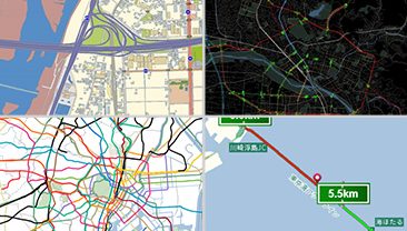
Furthermore, linking driving images with our map database "MapFan DB" opens up new possibilities for applications.
By linking driving images to road information included in MapFan DB, research and development of road analysis and route search becomes possible. For example, by classifying and analyzing scenery from driving images into scenes such as "urban landscapes with many man-made structures," "natural landscapes with forests and the sea," and "suburban roads with continuous rural scenery," it is possible to understand what kind of scenery can be seen and to what extent on each route. Applying this technology, it is possible to develop new route search services that meet user needs, such as "driving routes with good scenery" or "routes that prioritize open roads," and to propose new tourist routes to tourists.
Over 20 years, we have accumulated 4 billion images of vehicles in motion. By utilizing this data asset, we will continue to contribute to the realization of a more convenient and safer society.


Inquiries regarding services for corporate clients
For inquiries, please click here.

Related articles
-
 2025.11.18Newsletter
[GT Times #1] A thorough explanation of the evolving world of OOH advertising
-
 2025.12.24Newsletter
[GT Times #2] Deciphering Tourist Movements with people flow Data: The Impact of Natural Disasters on Toyama Tourism
-
 2026.03.26Newsletter
[GT Times #4] Understanding "Geo-Promotion Ads" in 5 Minutes: Solving Advertising Challenges with people flow Data and Values Data
